By:
Bob Henson
, 4:28PM,GMT on March 25,2016
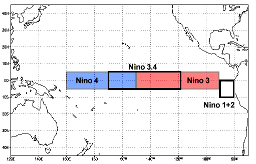
It’s not hard to find evidence of El Niño in decline. Sea surface temperatures (SSTs) are steadily dropping in and around the benchmark Niño3.4 region and elsewhere over the central and eastern tropical Pacific (Figure 1). After peaking at 3.1°C above average in late November 2015--the highest weekly value on record--the Niño3.4 SSTs were down to 1.7°C above average last week. Other indicators suggest that El Niño is hanging on by its fingernails. Beneath the veneer of warm SSTs, subsurface waters throughout the tropical Pacific have grown increasingly cooler (Figure 2).
Figure 1. Weekly anomalies (departures from seasonal average) in sea surface temperatures for the period March 13-19, 2016. Warm anomalies persisted over the central and eastern tropical Pacific, although less impressive than at their peak several months ago. Image credit: NOAA/ESRL/PSD.
Figure 2. Vertical cross section of temperatures (top) and anomalies (bottom) across the equatorial Pacific Ocean for the period March 19-23, 2016. Cooler-than-average waters now dominate the top 200 meters (600 feet) of the equatorial Pacific, although the surface layer remains warm. Image credit: TAO Project Office, NOAA/PMEL.
During a strong El Niño event, trade winds weaken, and recurrent periods of westerly wind help push warm water toward the eastern tropical Pacific. Surface winds averaged over a five-day period are now blowing from east to west across the entire tropical Pacific, a sign of rejuvenated trades.
All these indicators line up nicely with the classic mode of decay found in other strong El Niños of the past few decades. According to the official monthly outlook from NOAA’s Climate Prediction Center, issued on March 10, “A transition to ENSO-neutral is likely during late Northern Hemisphere spring or early summer 2016.” What’s less certain is what will happen after the Pacific enters a neutral state, assuming that it does.
“I’m going to say there’s a 99.9% chance we see El Niño conditions break down by this summer,” Michael Ventrice (The Weather Company) told me in an email. All of the five analog years since 1950 analyzed by Ventrice and colleagues bring the Pacific into neutral territory (Niño3.4 SSTs within 0.5°C of the seasonal average) by later in the year. Forecast models are in near-universal agreement that neutral conditions will prevail by this summer, and it looks increasingly likely that the tropical Pacific will continue cooling, with La Niña conditions possible by autumn. However, there’s just enough uncertainty to keep forecasters sweating it out.
Springtime obscures the crystal ball
What’s known as the spring predictability barrier makes this the toughest time of the year to anticipate how the El Niño–Southern Oscillation (ENSO) will behave. ENSO refers to the coupled atmosphere-ocean process that swings between El Niño and La Niña. About half of the time, neutral conditions prevail, with El Niño and La Niña roughly splitting the other 50% of the time. El Niños have been more frequent overall in recent decades, but La Niñas are more likely to recur for two or three years in a row.
Figure 3. El Niño and La Niña events since 1950, as defined by the Oceanic Niño Index, which tracks the events through three-month rolling averages of sea surface temperatures across the Niño3.4 region of the eastern tropical Pacific. “Very strong” or “super” El Niño events are those where at least one three-month average is at least 2.0°C above normal. Image credit: Jan Null, Golden Gate Weather Services, using data from NOAA (see the link for a larger version of this graphic).
In tandem with the seasonal cycle across the tropical Pacific, both El Niño and La Niña tend to strengthen toward the end of a calendar year and weaken during the first half of the next year. Thus, it’s easier to project the evolution of an El Niño or La Niña event as it’s taking shape, during the northern fall, than to anticipate what will emerge by the next fall.
Figure 4 (below) demonstrates the spring predictability barrier in all its glory. After being tightly clustered for the next couple of months, the various models diverge drastically by the coming autumn. If there’s a consensus, it’s for a weak La Niña to emerge by the latter half of the year. Several models have a moderately strong La Niña in place as soon as late summer, while a couple of other models bring back El Niño for a return visit by late 2016. It turns out that at least two of the models favoring El Niño (the CCSM4 and CFSv2 models, seen in Figure 4) were being swayed by an implausibly cold Atlantic--the type of initialization problem where unrealistic starting-point data can lead to unorthodox model behavior down the line. As Figure 4 shows, the LDEO model favors El Niño more strongly than any other, and that model is a fairly simple Pacific-only model without any Atlantic initialization.
Update: NOAA is announcing on Friday that an adjustment to the initialization system used for CCSM4 and CFSv2 is being implemented on Monday, addressing the cold bias in the Atlantic Ocean. Importantly, when it tested this adjustment, NOAA found a major shift: "the long-lead forecasts evolved from the current El Niño event into neutral or La Niña conditions during the next 9 months in the Nino3.4 SST plumes." Here's a NOAA technical briefing on the results. The NOAA/CPC outlook issued last week, which factored in the model initialization concerns, called for a roughly 50% chance of La Niña conditions by fall. I wouldn't be surprised to see those odds going up in April.
Figure 4. Projections of various forecast models for the evolution of SSTs in the Niño3.4 region over the next few months. These forecasts were compiled and released in mid-March. El Niño is in place when SSTs are at least 0.5°C above average for five overlapping three-month periods. La Niña is defined the same way, except that SSTs are below rather than above average. The bottom axis shows abbreviations for three-month intervals (e.g., JJA is June-July-August). Image credit: International Research Institute for Climate and Society.
The classic, but not guaranteed, hand-off from El Niño to La Niña
Our physical understanding of ENSO suggests that the models calling for La Niña may indeed be on the right track. Veteran researcher Anthony Barnston (International Research Institute for Climate and Society, or IRI) lays out the science behind the “delayed oscillator theory” in an easy-to-digest ENSO Blog entry from last January. In a nutshell, strong El Niño events trigger two competing forces: eastward-moving features called oceanic Kelvin waves, which straddle the equatorial Pacific, and westward-moving Rossby waves, located on either side of the equator. Passing each other like ships in the night, the Kelvin waves reinforce El Niño, while the Rossby waves head toward Indonesia and then bounce back eastward. At that point, months after their creation, they can lead to subsurface cooling that eventually shifts the system from El Niño toward La Niña.
One might expect that the stronger the El Niño, the stronger the Rossby waves that help lead to its demise. Indeed, Barnston shows that during the NOAA-favored period of most reliable records (1950 to today), stronger El Niño events tend to correlate with cooler SSTs a year later. The strongest events in this NOAA dataset are the “super” El Niño events of 1997-98 and 1982-83, along with a close runner-up, 1972-73. All three were followed by La Niña conditions a year later. (The cooling in 1983-84 was too brief to qualify as a La Niña event, but it was followed by a bona fide La Niña in 1984-85.) Out of the ten moderate or stronger El Niños analyzed by Barnston, six were followed by La Niña conditions a year later—but two were followed by neutrality, and the other two saw a redevelopment of weak to moderate El Niño conditions.
Figure 5. Scatterplot showing the relationship in ENSO states from one year to the next, for every year since 1950 in which an El Niño occurred. Each dot represents a pair of “year 1 vs. year 2” ENSO states. In general, the stronger the El Niño (higher values on the x-axis), the stronger the subsequent La Niña (lower values on the y-axis). The ENSO states here are drawn from Niño3.4 SSTs (the Oceanic Niño Index) for the six overlapping three-month periods from August-October to January-March. Data are not completely in for 2015-16, but this future dot should end up close to 2.0°C on the x axis, which implies that La Niña is historically likely in 2016-17. For more details and a larger version of the graphic, see the associated ENSO Blog post by Anthony Barnston published on Jan. 28, 2016. Image credit: NOAA, courtesy Anthony Barnston.
Forward into the past
WU member Eric Webb (North Carolina State University, @webberweather) has been digging even further back into El Niño history. Over the last few months, Webb has been refining his own Ensemble Oceanic NINO Index, a product that draws on 26 long-term datasets and analyses created by institutions around the world. Stretching back to 1865, Webb’s index identifies “super” El Niños in 1877-78 and 1888-89 as well as 1972-73 (deemed “super” in Webb’s index), 1982-83, and 1997-98. One motivation behind incorporating multiple datasets is to help alleviate some of the issues with older data that have led NOAA/CPC to focus on the post-1950 period in its own analyses, including the historical ENSO dataset shown in Figure 3. Webb has also been working on a confidence index that assesses how well five leading ENSO definitions agree from period to period.
With the help of Webb’s index, the argument for La Niña in 2016-17 gets even stronger. All five of Webb’s “super” events were followed by La Niña events that lasted two to three years. Yet none of the eight strong El Niño events that fell below the “super” threshold (1896-97, 1902-03, 1965-66, 1991-92, 1957-58, 1940-41, 1987-88, and 1930-31) produced multiyear La Niña events. “In fact, many weren't even followed by a La Nina in the subsequent year,” Webb told me. “This is a very intriguing statistic, and it likely highlights the role for properly initializing ENSO intensity with respect to forecasting its behavior beyond the spring predictability barrier, much less a year or two in advance. This also provides a potential future avenue of research for assessing its behavior in specific ENSO scenarios.”
Although Webb’s work has yet to be peer-reviewed, it points in the same direction as other research: a powerful tendency for big La Niñas to follow big El Niños. “Eric’s statement sounds quite reasonable to me,” said IRI’s Barnston. “I don’t think any expert could disagree with it. Given the inherent limit of predictability, there may not be very good low-hanging fruit, but it doesn’t hurt to keep trying.”
The case for El Niño
“A transition to La Niña is not a done deal,” according to Klaus Wolter (NOAA Earth System Research Laboratory). Wolter and colleague Michael Timlin (Midwestern Regional Climate Center) developed the Multivariate ENSO Index (MEI), which employs both oceanic and atmospheric variables and goes back to 1871, providing yet another perspective. In a 2011 paper, Wolter and Timlin found a close relationship between the strength and longevity of La Niña events. The picture gets a bit more complex for El Niño: “super” events typically last 12 to 18 months, while other strong events have actually persisted for more than two years. “I find it interesting that 1930-31, 40-41, and 1991-92 [all strong El Niño years] were followed by long-lived El Niño conditions,” Wolter said in an email.
One more wrinkle to consider is the Pacific Decadal Oscillation. As we discussed early last year, El Niño events become more likely when the PDO is in its positive mode, which was the case in the 1980s and 1990s. Now that the PDO has been consistently positive for more than two years, we may have entered a longer-term positive mode, which would favor El Niño more often than La Niña.
The upshot: While current observations show El Niño decaying, and the strength of the 2015-16 event argues for a good chance of La Niña in 2016-17 (conceivably lasting more than a year), it’s still a bit too soon to entirely rule out a repeat visit from El Niño later this year.
Figure 6. The Atlantic hurricane seasons that followed the two most recent “super” El Niño events (1982-83 and 1997-98) are a study in contrasts. The 1983 season (left) was the quietest post-1970 Atlantic season on record in terms of accumulated cyclone energy, with only 4 hurricanes and 3 named storms. The 1998 season (right) produced 14 named storms, 10 hurricanes, and more than $3 billion in damage, as well as the catastrophic Hurricane Mitch, which killed more than 10,000 people as it decayed over Central America.
Implications for the 2016 Atlantic hurricane season
It’s well established that El Niño years tend to suppress tropical cyclone action in the North Atlantic, due to increased upper-level wind shear and other factors, while La Niña tends to favor above-average activity in the North Atlantic. Timing makes a big difference: if a transition to La Niña happens late in the year, it’s less likely to influence the Atlantic hurricane season. The forecast team at Colorado State University led by Phil Klotzbach and William Gray will issue their first outlook for the 2016 Atlantic season on April 14. Klotzbach stresses another key factor now in play alongside El Niño and La Niña--the recent apparent switch toward a cool mode of the Atlantic Multidecadal Oscillation (AMO), which we’ll be discussing in a future post. Here’s what Klotzbach had to say when I asked him about the AMO and other factors leading into the 2016 season:
“The far North Atlantic has been quite cold for about three years now. This cold anomaly especially stands out at present, given how warm the remainder of the globe is due in part to the strong El Niño. When the far North Atlantic is cold, it tends to force wind and pressure patterns that then cool the tropical Atlantic. We've seen a significant cooling of the eastern subtropical Atlantic in recent weeks [see Figure 7 below], and there is the potential that these cold anomalies could propagate into the tropical Atlantic for the peak of the Atlantic hurricane season. If this occurs, there is the potential that the hurricane season may not be particularly active.”
We’ll be back with our next post on Monday. In the meantime, have a great weekend, everyone!
Bob Henson
Figure 7. Trend in sea-surface temperatures across the eastern tropical Atlantic for early March 2016 as compared to January 2016. Image credit: NOAA/ESRL/PSD, courtesy Phil Klotzbach.
No comments:
Post a Comment