Published: October 27,2015
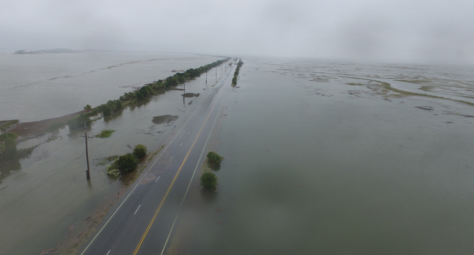
(Steve Petyerak/The Weather Channel)
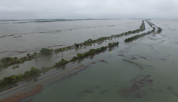
(NOAA)
Coastal flooding closed several streets and intersections on the Charleston peninsula Tuesday morning, according to the Charleston Police Department.
Tide levels at Charleston's harbor topped out at 8.686 feet above mean lower low water level, the location's fourth highest tide on record, dating to 1921.
Only three events produced higher tides at Charleston Harbor: Hugo on Sep. 21, 1989 (12.56 feet), an August 11, 1940 hurricane (10.27 feet) and a New Year's Day 1987 coastal storm (8.84 feet) produced higher tides at Charleston Harbor.
Tuesday's tide level was 4-5 inches higher than the peak measured during the historic South Carolina flooding and coastal flooding event earlier in October. Fortunately this time, there wasn't 17-27 inches of rainfall occurring at the same time.
(RECAPS: Unprecedented Early Oct. Rain)
Flooding inundated roads in Isle of Palms, South Carolina, including Palm Boulevard, 41st and 25th Streets. Water flowed under waterfront homes and a condominium complex, according to the National Weather Service.
Tidal flooding was also reported in Folly Beach, Hilton Head, Beaufort, Edisto Beach, Kiawah Island and North Myrtle Beach, South Carolina.
A restaurant was flooded on Hilton Head Island and a golf course was partially submerged.
Floodwaters swamped several homes on Fripp Island, between Charleston and Hilton Head Island. The nearby Hunting Island State Park campgrounds were flooded, as well. Traffic was not allowed on the island due to widespread flooded roads, there.
Along the Georgia coast, tidal flooding at Ft. Pulaski National Monument east of Savannah was the highest since the 1940s and third highest on record dating to 1935, topping out at 10.427 feet.
Again, only two hurricanes -- Oct. 15, 1947 and Aug. 11, 1940 -- produced higher tides above mean lower low water level at Ft. Pulaski.
U.S. 80, the only road from Savannah to Tybee Island and Ft. Pulaski was flooded and closed Tuesday.
(INTERACTIVE: Coastal Flood/Marine Alerts)
Instead, the pressure gradient between strong high pressure centered over the Northeast U.S. and low pressure over the northern Gulf Coast set up the persistent east to northeast winds driving water ashore.
Together with that were the monthly spring tides, the highest tides of the month corresponding to this month's full moon, known as the Hunter's Moon.
South Carolina and Georgia weren't the only ones dealing with coastal flooding. Minor flooding inundated some streets around high tide Tuesday morning in Miami Beach, Delray Beach and West Palm Beach.
High tides swamped docks on Perdido Key, Florida, Monday.
Minor flooding was also reported in Waveland, Mississippi, Slidell, Louisiana, as well as Lower Plaquemines and Terrebonne Parishes Sunday night into early Monday. Several inches of water inundated Louisiana Highway 1, the only road to Grand Isle and Port Fourchon, Louisiana.


No comments:
Post a Comment